NASA's Perseverance Mars Rover
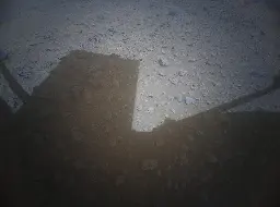
- Check this ! - Ingenuity just before taking off on Flight 54

Processed by James Sorenson. High on the list of my favourites mission images (so far) Distance 57.3 meters. We're still waiting for the movie frames the rover captured during flight 54, those movies will be rather special :)
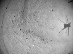
- Expertly processed - Helicopter images the Rover by James Sorenson (Flight #54)

Credit: NASA/JPL-Caltech/James Sorenson
- Helicopter captures rover during flight on Aug 4, 2023 (sol 872)

This is a very roughly processed image from the helicopter's 54 flight, a test to reset it's localization data after having issues on the 53rd fight.
- Daily Records of Atmospheric Temperature With Perseverance (New mission Blog)mars.nasa.gov Daily Records of Atmospheric Temperature With Perseverance - NASA
Atmospheric temperature is a meteorological variable of daily concern to humans.
- Mars Sample Return in jeopardywww.space.com NASA's Mars Sample Return in jeopardy after US Senate questions budget
If NASA doesn't come up with a tighter budget for the mission, Mars Sample Return may not happen.
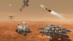
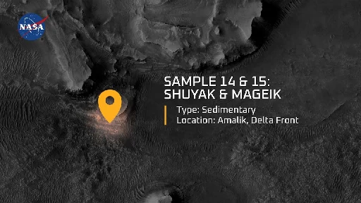
- Meet the Mars Samples: Shuyak and Mageik (Samples 14 and 15)
YouTube Video
Click to view this content.
Learn more about Samples No. 14 and 15 – “Shuyak” and “Mageik,” a pair of sedimentary rock core samples that excite scientists because, on Earth, this type of sedimentary rock preserves signs of life for a very long time. If that same process also occurs on Mars, it could help us understand if life ever existed there.
- Ingenuity from 14 meters

Perseverance on its way to RMC 42.2700 made a stop to take a picture of its companion, Ingenuity, at RMC 42.2360. The team apparently intended the image to be very detailed so they used Mastcam-Z with a focal length of 110mm from a distance of 14m!
Processed MCZ_LEFT, FL: 110mm Sol: 871, RMC: 42.2360, LMST: 13:13:30 Original: https://mars.nasa.gov/mars2020-raw-images/pub/ods/surface/sol/00871/ids/edr/browse/zcam/ZL0_0871_0744265587_568EBY_N0422360ZCAM05155_1100LMJ01.png Credit: NASA/JPL-Caltech/ASU/65dBnoise
Source: https://fosstodon.org/@65dBnoise@mastodon.social/110822316687935759
- Flight 53 may have had issues. It was much shorter than planned, and only reached an altitude of 5 meters, plus we have missing data and no images.

It could be messed up data from the helicopter, or there could be a problem with the helicopter. Whatever it was the helicopter is safe on the ground and even sent images from earlier flights after landing. But the lack of images from flight 53 is very odd.
- Watch Mars Guy for a weekly digest of rover activity
It's a wonderful YouTube channel posting once a week, on Sundays.
- 868 post-drive map with scale - Includes estimated location of flight 53 landing site.

Awaiting the JSON data from JPL to formalise the location and path of the flight
- Ingenuity spotted after flight 53 - Northeast of the rover on sol 868 - MastCam-Z at 63mm zoom. Estimated distance just over 200 meters

Need JSON data to establish the precise distance but that will have to wait until JPL release the data. Credits for spotting it to Mars Stu, and reported by @65dBnoise@mastodon.social
- 868 - Another drive to the West - About 75 meters. Ingenuity flight 52 landing site is about 90 meters WSW in the yellow rectangle

I cant see the helicopter in the image, it should be on the bank of Fall River Pass, so it's either behind the rocky terrain or it may have already flown north for flight #53.
This image was assembled from 16 tiles. Zoom in for full resolution.
No formal drive data or map yet, I'll post that ASAP. Watch this space
- IMGUR Album: All 5 sol 866 post-drive NavCams (Natural colour)imgur.com Perseverance rover checks out its new location after a drive to the West of 119 meters (390.7 ft) during sol 866 (July 28, 2023)
Discover topics like science, perseverance, planet mars, rover, nasa, and the magic of the internet at Imgur, a community powered entertainment destination. Lift your spirits with funny jokes, trending memes, entertaining gifs, inspiring stories, viral videos, and so much more from users like PH1951...
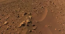
Perseverance rover checks out its new location after a drive to the West of 119 meters (390.7 ft) during sol 866 (July 28, 2023). Attached are the 5 post-drive tiled NavCam mosaics acquired on completion of the drive at site 42/776. The rover's total traverse since landing is 19.2 kilometers (11.93 miles). The rover completed the drive at a slightly higher elevation 0.35 meters (1.14 feet). Airfield Xi, the helicopters landing location at the end of flight 52 is to the West of the rover. The distance between Perseverance and Ingenuity at airfield Xi is 164.2 meters (538.7 feet). Since the drive the helicopter has been busy sending images from earlier flights to the rover for onward relay to Earth. Image credits: NASA/JPL-Caltech/Steven Albers
- Data / Stats for the drive during sol 866

This is extracted from JPL's JSON data URL's for the rover and the helicopter.
If anyone wants the URL info for the JSON files let me know
If anyone wants access the the spreadsheet that I created to extract this data let me know. If there is interest I'll create a read only version on Google Sheets
- Updated (annotated) map (with scale) after the drive on sol 866

This was screen shot from https://mars.nasa.gov/maps/location/?mission=M20
- looking west-northwest after a drive of 119 meters (390.7 feet) during mission sol 866 (July 28, 2023)

I will post all 5 of the post-drive NavCam images later.
Perseverance rover looking west-northwest after a drive of 119 meters (390.7 feet) during mission sol 866 (July 28, 2023).
Airfield Xi is 164.2 meters (538.7 ft) to the West (Ingenuity's location after flight #52).
Image credits: NASA/JPL-Caltech
- Having failed to get a core at Mt Meeker. It's time to move on

Social media post from NASA
This is one HARD rock! I gave it a go with my coring drill, but it seems this one doesn’t want to give up all its secrets. Still, I can study it more with my science instruments and use my drill next time. Sometimes the better part of perseverance is knowing when to move on!
#PerseveranceRover
- Ingenuity Helicopter flight 49 RTE - Altitude 16 meters (52 feet)

Ingenuity captured this photo with its RTE (Return To Earth) color camera on Flight 49 which occurred on Sol-752 (April 2, 2023). James Sorenson did some extra processing to this picture to set the framing as well as color balance it to better approximate what the scene would really look like as if someone were flying with Ingenuity at an altitude of 16 meters (52 feet) off the ground.
Image credits: NASA/JPL-Caltech/James Sorenson
I just checked the image server and the helicopter has returned over 8,000 images, and there are hundreds more still on the helicopter
RTE: 419 NavCam: 7952 Total: 8371
- "Image of the Week" for Week 127 (July 16 - 22, 2023)

Perseverance rover acquired this image using its Left Mastcam-Z camera. Mastcam-Z is a pair of cameras located high on the rover's mast.
This image was acquired on July 21, 2023 (Sol 859) at the local mean solar time of 11:59:53.
Image Credit: NASA/JPL-Caltech/ASU/MSSS
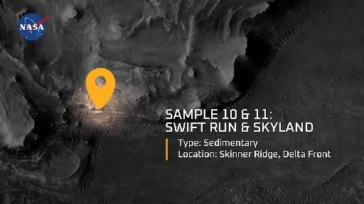
- Learn more about Samples #10 & #11 - Swift Run & Skyland
YouTube Video
Click to view this content.
Learn more about Samples No. 10 and 11 - “Swift Run” and “Skyland,” the first rock samples collected by the Perseverance rover from an ancient river delta environment on Mars. Scientists are particularly excited about studying such sedimentary rock samples up close because they form through interaction with liquid water and may have good potential for preserving signs of ancient life.
Read about all the carefully selected samples: https://mars.nasa.gov/mars-rock-samples
Learn more about the Mars Sample Return campaign: https://mars.nasa.gov/msr
Credit: NASA/JPL-Caltech
- Never a good day when you chip a tooth.

Mount Meeker - MastCam-Z - Sol 864
Thankfully they have a bunch of spares drill bits...
- The map quadrangles in Jezero are informally named after Earth based national parks or preserves. The assigned map name will then form the 'theme' for naming targets of interest within that map

Jezero crater has been divided into more than one hundred map quadrangles to aid geological mapping. Each of these square areas of interest spans 0.025 degrees in latitude by 0.025 degrees in longitude, each quadrangle measures about 1.5 kilometers square or about 1.22 x 1.22 km. (0.75 x 0.75 miles)
The map quadrangles in the crater are informally named after Earth based national parks or preserves. The assigned map name will then form the 'theme' for naming targets of interest within that map.
- Ingenuity sticks a 3-pt landing (Mars Guy episode 120)
YouTube Video
Click to view this content.
- Animation of the 'Dragons Egg' abrasion by Simeon Schmauß
Video
Click to view this content.
Simeon posted this on Mastodon, here is a link, check out the entire thread https://fosstodon.org/@stim3on/110753196762249799
This is the first GIF I have posted here, fingers crossed it works
- 'Dragons Egg' Rock Abrasion, sol 859 - 3D model by Mastcam-Zsketchfab.com M2020 WATSON -- Dragons Egg abrasion, sol 859 - Download Free 3D model by Mastcam-Z
Dragons Egg Rock abrasion - M2020 WATSON -- Dragons Egg abrasion, sol 859 - Download Free 3D model by Mastcam-Z
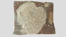
Dragons Egg Rock Abrasion interactive model
#mars2020 #perseverancerover #map #data #marsrover #mars #NASA #Space #Science #3dmodel
Credits: NASA/JPL-Caltech/ASU/MSSS
- Abraded patch on 'Mount Meeker' - Sol 859: SHERLOC camera. Stretched colour. Abraded patch diameter 5cm / 2 inch (more in body text)

Perseverance rover abrades a new patch. This time on 'Mount Meeker' during sol 859. It was imaged with its SHERLOC WATSON camera. I have stretched the colours to highlight the different materials present in the abraded surface. The diameter of the patch is approximately 5 centimeters (2 inches). Image Credits: NASA/JPL-Caltech
- NASA’s Perseverance Rover Sees Mars in a New Light - Follow the link in the body text for the full News Release

Full news release with full resolution images etc
- Perseverance rover places its abrasion tool on 'Mount Meeker'. HazCam image from Sol 858

Image from the rover's wide-angle - front-left hazard avoidance camera acquired on sol 858
- Flight 53 Preview – By the Numbers - NASA
Flight 53 Expected Flight date: 07/22/2023 Horizontal flight distance: 666.34 feet (203.1 meters) Flight time: 136.82 seconds Flight altitude: 32 feet (10 meters) Heading: North Max Flight speed: 5.6 mph (2.5 meters per second) Goal of flight: Scouting flight
- Perseverance Views Jezero Boulder Field (calibrated colours)

This composite image captured by NASA's Perseverance Mars rover shows boulders that decorate the top of the Jezero Crater fan deposit. Rover tracks across the middle of the image give a sense of scale. These boulders were transported by water that was either deeper or flowed faster than the ancient waterway that deposited the smaller pebbles that also populate the area. Because these boulders are sitting on top of the pebbles, scientists believe they arrived later, possibly much later. Perseverance's Mastcam-Z camera system took the series of images that make up this composite on July 6, 2023, the 845th day, or sol, of the rover's mission to Mars.
This version uses 'Natural Colour' calibrated images'. Image Credit: NASA/JPL-Caltech/ASU/MSSS/PIA25963 (reprocessed)
Source of calibration: https://mastcamz.asu.edu/mars-images/images-videos/?from_sol=845&to_sol=845&limit=300&item_type=natural-color-images
- The rock core nicknamed "Otis Peak" on June 12, 2023, the 822nd day, or sol, of the mission. (More in body text)

Perseverance Mars rover captured this image of a rock core nicknamed "Otis Peak" on June 12, 2023, the 822nd day, or sol, of the mission. The image shows the bottom of the Otis Peak core, which was collected from a conglomerate rock called "Emerald Lake." The distinctly colored areas are individual minerals (or rock fragments) transported by the river that once flowed into Mars' Jezero Crater.
The image was taken by Perseverance's Sampling and Caching System Camera, or CacheCam, located inside the rover underbelly. The camera looks down into the top of a sample tube to take close-up pictures of the sampled material and the tube as it's prepared for sealing and storage.
Image Credit: NASA/JPL-Caltech/PIA25962
Source: https://photojournal.jpl.nasa.gov/catalog/PIA25962


